The Canadian Arctic is vast!
“How big is it” you may be asking?
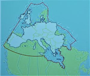
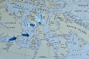
Larger than all of Europe, as you can see on the overlay map below.
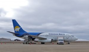
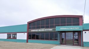
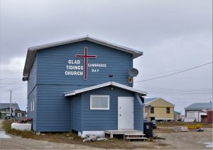
We all (144 passengers on the RCGS Resolute) gathered in Edmonton on “Day 0”, had the “mandatory briefing” at 6:30 PM, and left the hotel at 5AM the following morning (Day 1); flew to Yellowknife; switched to another aircraft which was equipped to land on the “standard” gravel runways in this remote part of the world; flew further north to Cambridge Bay (above the Arctic Circle), had a walking tour (and Narwhal snacks at the community center) in this frontier settlement and then boarded Zodiac’s for the final transfer to the Resolute.
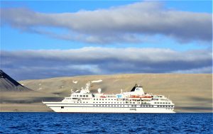
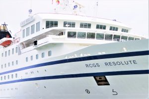
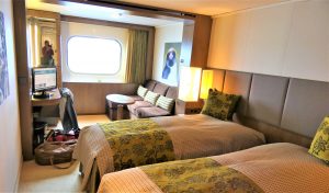
The RCGS [Royal Canadian Geographical Society] Resolute awaited us. It’s a very comfortable (luxurious compared to my two prior Antarctic cruises) ice-strengthened ship, designed for Arctic and Antarctic Expeditioning, and we settled in.
Our route (which changed slightly from “the plan” because of weather and pack ice, even this late in the season) took us past Victory Point on King William Island, which was, unfortunately, fog-bound.
Victory Point is a wide, low, clearly visible beach, where the Franklin Expedition erected cairns (message posts) in 1845, where their last communications were recorded. Unfortunately, the fog prevented our even getting a glimpse of this important, historic, spot.
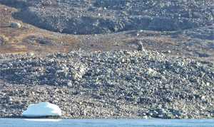
We motored further north to Coningham Bay (on the shore of Prince of Wales Island), a very interesting shallow bay where Beluga whales come close in-shore to “rub, scrub and scratch” on the rocks, to their delight….and to the delight of the local Polar bear population when one or more of the Beluga’s are stranded when the tide goes out.
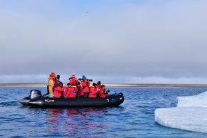
We toured that area in Zodiacs, getting close in to shore.
We then continued North and east, through Bellot Straight (which narrows down to 1km in width, with tricky currents, up to 7 turbulent knots during peak flow).
Another historic channel.
It was one of the “missing links” in the Northwest Passage, AND, it separates the northernmost end of the North American Continent from Somerset Island and the other islands stretching far to the north.
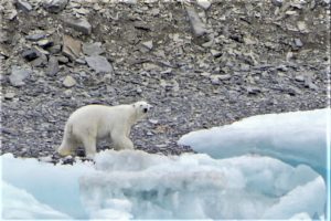
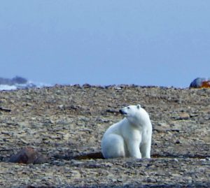
We saw a polar bear scrambling high up on the cliffs on the Somerset Island (North side), apparently searching for bird’s eggs / nests, and Musk Oxen on the South, or North American Continent side, and a lone Narwhal swimming down the middle of the channel, headed for Alaska; quite an amazing experience.
The Cairn on the upper right is the “official” demarcation of the northernmost point of the North American Continent.
In October 2018 I was at Cape Agulhas; the southernmost point of Africa, and in January 2019 I was at Cape Horn; the southernmost point of South America and now; September 2, 2019 the northernmost point of North America (and heading further north from there through the Canadian Arctic Archipelago).
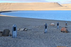
Anchored for the night at the site of “Fort Ross” – another historic spot, both a “search location” for the missing Franklin Expedition and a Hudson’s Bay Company fur trading post – now abandoned, but two buildings remain standing.
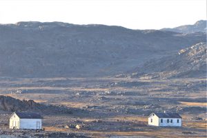
A planned morning landing and exploration was vetoed by the safety team, because of “wandering” Polar Bears in the area (and 30 knot winds which would have been a “challenge” even without the bears), so we continued north along the east coast of Prince Leopold Island to another historic spot – Beechey Island, where the Franklin Expedition overwintered (1845/46), by their choice [the following winter they were frozen in at a still unknown location].
Three members of the crew are buried there, and the grave sites are still hauntingly there.
This was the furthest north point of our trip – 74 degrees, 43 minutes north; only 917 Nautical Miles from the North Pole (considerably farther north of the Arctic Circle, which is at 66 degrees, 33.4 minutes).
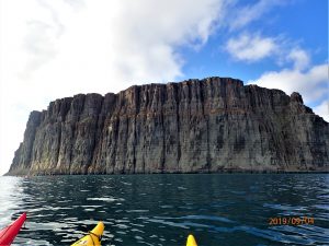
The weather here was gorgeous and we FINALLY got the Kayaks into the water for a truly amazing series of views, from the high cliffs on the west end of the island, to an up-close view of the shoreline (and a beach landing to pay our respects at the grave-sites).
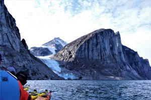
We continued along Lancaster Sound on the southern coast of (uninhabited) Devon Island to Dundas Harbor and then to Cunningham Glacier, for more great experiences.
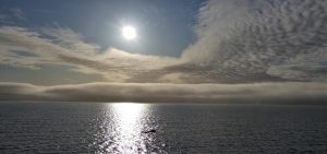
When we went out in the Kayaks in the early morning at Dundas Harbor there was skim-ice on the surface of glass-smooth calm seas; a sure sign that the arctic summer was quickly coming to the end.
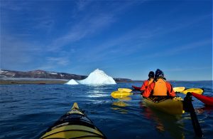
As we headed to Cunningham Glacier (which is a tongue of the large ice-pack which covers most of Devon Island) the weather gods continued to smile, and there was some more wonderful kayaking in a light swell, navigating around some smallish icebergs and paddling through the brash ice – smaller bits that fall of the bergs as they melt, which is a slightly noisy, but delightful, experience.
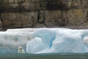
Some of our fellow adventurers went ashore at the toe of the glacier after the safety team had declared the area “bear free”.
The student team from Waterloo College, on board the Resolute for field work, went up onto the glacier to a point a kilometer from shore to install a remote sensor to monitor glacial degradation. They (and the guides) spotted a previously unseen Polar Bear (white on white – hard to spot) and they beat a hasty, but orderly, retreat to the shore, and the ship.
Our guides are all very well trained, and well-armed and radio communications are excellent but “little unexpected incidents” such as these reinforce the explorers maxim “expect the unexpected” and further point out how fragile the interface is between the natural environment and “adventure” or “expedition” tourism, and how secure and well run the entire One Ocean Expedition operation is for those of us who are fortunate enough to experience it.
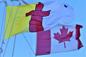
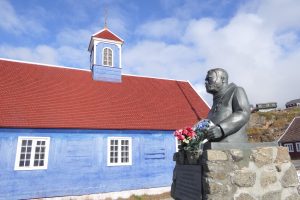
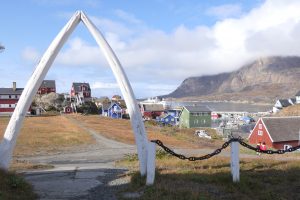
Our next stop was a landing at the village of Pond Inlet (Mittimatlik in Inuit); population 1,600, on Baffin Island, where we were greeted with friendly open arms, shown the community and a terrific museum, and had a wonderful introduction to the Inuit Culture.
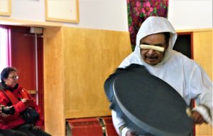
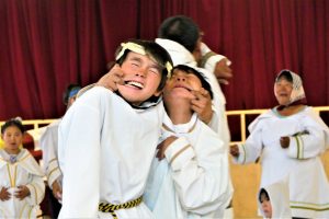
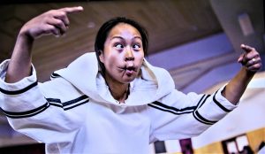
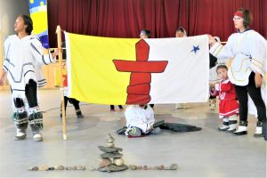
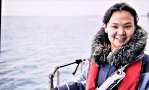
Pond Inlet is also the home of one of our guides on the ship, Alex Anaviapik; a charming young woman who was, it seemed, everywhere, every day, helping us to understand the native culture.
Alex and I had a delightful time together during the trip, and my family has now grown by one, as she asked me to be “Uncle George”, which I gladly accepted.
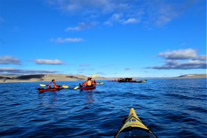
Gibbs Fjord on the coast of Baffin Island was the next stop. Spectacular scenery, and a wonderful, but strenuous, Kayak adventure – 5km in 90 minutes, through some pretty “noticeable” headwinds and swells, but it was really worth it.
The Zodiac tours we’d been experiencing were wonderful, of course, but there’s something extremely serene and gratifying to go “sightseeing” in these remarkable areas under your own power with a small group of like-minded folks.
Isabella Bay was the next (and final Canadian) stop on this remarkable journey. After “surviving” the Gibbs Fjord Kayak Adventure (as “front man” in a two-person kayak) I summoned the courage to “go single” (albeit in somewhat calmer waters).
WHAT A BLAST !
Flirting among the curious seals and the not-so-curious whales, solo in a little red boat, was fantastic.
I celebrated in the well-stocked bar that evening with a Grand Marnier, on the rocks, but the “rock” was also special; a chunk of very ancient glacier ice that we plucked out of the ocean – a very special commemorative treat.
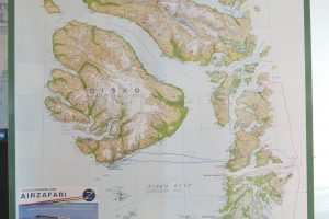
We had a 400 nautical miles overnight journey across Baffin Bay to Qeqertarsuaq; a village on Disko Island (in Disko Bay) on the western coast of Greenland.
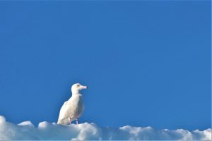
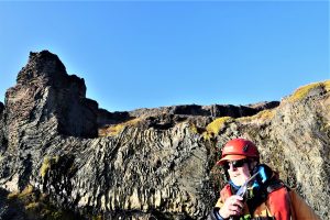
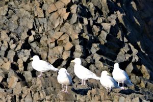
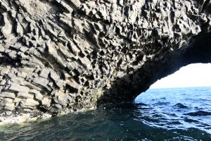
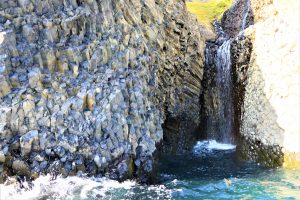
Another bright, sunny day, with magnificent volcanic coastal geology, amazing structures, wonderful shore birds. A brilliant day.
The day ended with a Polar Plunge into the (literally) freezing water, carefully supervised by Captain Hans and the Ship’s Safety Officer, Dan Owens (aka the Vagabond Dilettante), with a fully dry-suited rescue-diver also on the dive platform (who’s services were not needed), followed by a “warming plunge” into the ship’s heated pool.
I’ll post those pictures when I get them. Pretty outrageous, and fun.
We cruised overnight to Ilulissat, on the other (mainland) side of Disko Bay.
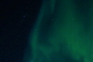
We saw spectacular Northern Lights on the crossing (hard to photograph without the “proper” equipment – best I could get, hand-held).
The next morning was cold and nasty, with enough swell and chop to keep the Kayak’s safely on board.
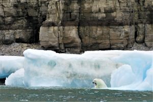
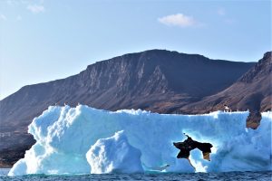
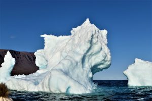
My upcoming wanderings in Greenland includes time in Ilulissat, so I didn’t go ashore with most of the others, but I and a few other hardy (stupid?) souls went out for a nasty-weather Zodiac “cruise” with “Captain Gregg” for some spectacular iceberg viewing; bergs calving into the Jakobshavn Isfjiord from the Jakobshavn Glacier (part of yet another UNESCO World Heritage site).
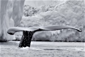
Despite the significantly unpleasant weather this voyage turned out to be the most rewarding one of the trip (from a wildlife standpoint), as I got this “Right Place, Right Time Very Lucky Picture”(RPRTVLP).
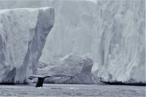
which was the winner of the “Best Wildlife Photo” contest for the voyage.
I’m looking forward to getting back to Taos with this one and turning the RAW file over to my dear friend Jack Leustig of Fine Art New Mexico who will work his magic and turn it into a truly sensational memory of this glorious trip.
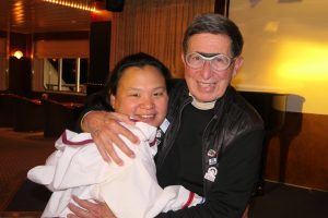
One more short cruise to Sisimiut and the Captain’s (farewell) Dinner
I was honored to be invited to sit at his table. A delightful (almost) end to the cruise.
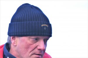
Captain Hans
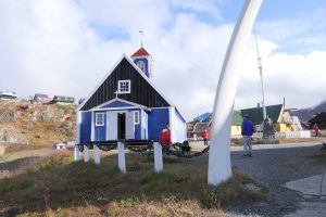
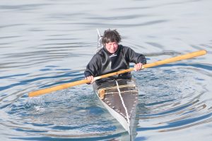
The last morning in Sisimiut was another amazing Kayak experience along the shore of this colorful Greenlandic Village.
Kayaking is basic transportation, and hunting transportation (before snowmobiles), and they’re incredibly skilled. This champion enthralled us with part of the “standard repertoire” of 25 different “Rolls” (how to get out of a perilous upside-down situation.
Amazing !
Then an afternoon and through-the-night final journey to the end-point (of this part of the trip) at the settlement of Kangerlussuaq – the site of a 1940’s US Air Force Base, built during World War II, and still operational for ice training exercises by the New York National Guard, and for scheduled and charter flights from “Kang” to Copenhagen and Canada. Most of the OOE passengers took a flight in one direction or other.
I, and one other adventurer stayed on…..but that’s another chapter.
G’by for now – much more to come – Greenland, Iceland, The Faroe Islands and Scotland

Wonderful George!
My pleasure, Jonty. Best to you all
Wonderful post, George, and wonderful photos. Thanks for this post.
Thanks, Yale, glad you enjoyed it.
Thanks for taking the time to share your great pics and stories! Keep ‘em coming!
Thanks, Tibbs. It’s being a blast. Miss y’all (sort of).
Simply awesome George
Thank for exploring for the rest of us
Thanks, Fred. Great to hear from you
Thanks, Dave. Have a blast in Umbria – hugs all around
Thanks Cristy and Dan, always wonderful to hear from you. Glad you enjoyed it.
Another Trip of a Lifetime!
Just another Trip for Explorer george, one to truly remember can’t wait to see all your Photo’s
Thanks, Shyena. Fingers crossed that the “lifetime” keeps extending on and on 🙂
Thanks, Connie. It’s been one rockin adventure after another. All the best on your Nepal Adventure
Thanks for taking us all along on this spectacular adventure …. love the polar bear pics and the tail! WOW!
Thans, Pam – I can’t resist, it’s a whale of a tale / tail